
If there’s one thing I know for sure, it’s that there are certainly no shortage of rambles on offer in the Lake District!
A diverse and incredibly stunning landscape, scattered around the National Park lies a whole host of craggy valleys, glistening lakes, formidable peaks, rolling pastures, cascading waterfalls, medieval castes and countless quaint villages.
With so much on offer, it’s not surprising that the National Park is well-known as a paradise for outdoor fanatics. The statistics don’t lie – it’s estimated the Lake District attracts upwards of 15.8 million tourists each year!
Nevertheless, with so many trails on offer, it’s normal for hikers visiting the Lakes to sometimes feel a tad overwhelmed. Just which are the very best walks to venture on?
In all honesty, I wouldn’t worry too much since you really can’t go wrong in Lakeland. Over the years I don’t think I’ve ever had one bad trek in the National Park!
Which walks you choose will simply come down where in the Lakes you’re situated and how much of a challenge you’re after.
To help whittle down your options, we’ve compiled a list of our personal favourite trails in the Lake District. Scattered all around the National Park and offering a variety of difficulty levels, I’m positive there’s a trail here for everyone!
The best Lake District walks
Buttermere Lake
Starting point: Cockermouth CA13 9XA
Distance: 4.5 miles (7.2km)
Difficulty: Easy

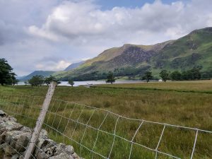
Starting off with a rather gentle ramble, Buttermere Lake is probably my favourite lake walk in the whole National Park.
A flat and easy-to-follow 4.5 mile trail, expect to be treated to stunning lakeside views and epic vistas of the surrounding peaks looming overhead.
Even better, after the ramble there’s always the option to grab some traditional pub grub (and maybe even a pint) at one of the village inns.
For those wanting to explore further, it’s also worth veering off the lakeside trail and checking out Sour Milk Gill waterfall.
For full route info, be sure to check out our Buttermere Walk Guide.
Scafell Pike (via Wasdale)
Starting point: Wasdale Head, Seascale CA20 1EX
Distance: 2.6 miles (4.2km)
Difficulty: Hard
One of the more difficult yet rewarding hikes in the Lakes, Scafell Pike is officially the tallest mountain in England.
Standing at an imposing 978 metres, Scafell Pike is on the bucket list of many a rambler, attracting over 100,000 eager hikers each and every year.
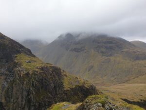
With a plethora of routes on offer – all providing a unique take on the peak – my personal favourite has always been the trail from Wasdale.
Notorious for its relentlessly steep gradient and precarious river crossing halfway up, this tends to also be the route taken by walkers attempting the National Three Peaks Challenge.
For more information on all the various routes on offer, be sure to check out our Scafell Pike blog post here.
Hodge Close Quarry
Starting point: Hodge Close, Coniston LA21 8DJ
Distance: 1 mile (1.6km)
Difficulty: Moderate
One of the lesser-known gems of the Lakes, Hodge Close Quarry is one of several historic and remote slate workings in the Tilberthwaite Valley and has even been labelled the ‘scariest cave in Britain’.
Also known as ‘skull cave’ due to the cavern entrance eerily resembling the shape of a skull, the quarry was even used as a filming location for Netflix’s fantasy drama ‘The Witcher.’
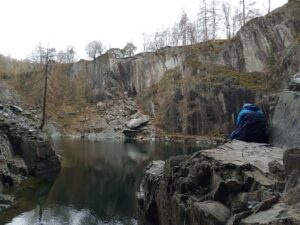
While the walk down to the cavern is rather short, I have labelled this walk as ‘moderate’ difficulty due to the relatively steep scramble segment up and down the quarry.
Likewise, the actual trail down to the quarry is quite well-hidden and easy to miss. For the full breakdown on how to navigate your way down to skull cave, then head on over to our detailed guide on Hodge Close Quarry.
Top tip – If you’re hankering for a longer ramble, why not extend your trek and also check out the nearby Cathedral Quarry?

Blea Tarn
Starting point: Ambleside LA22 9PG
Distance: 1.9 miles (3km)
Difficulty: Easy
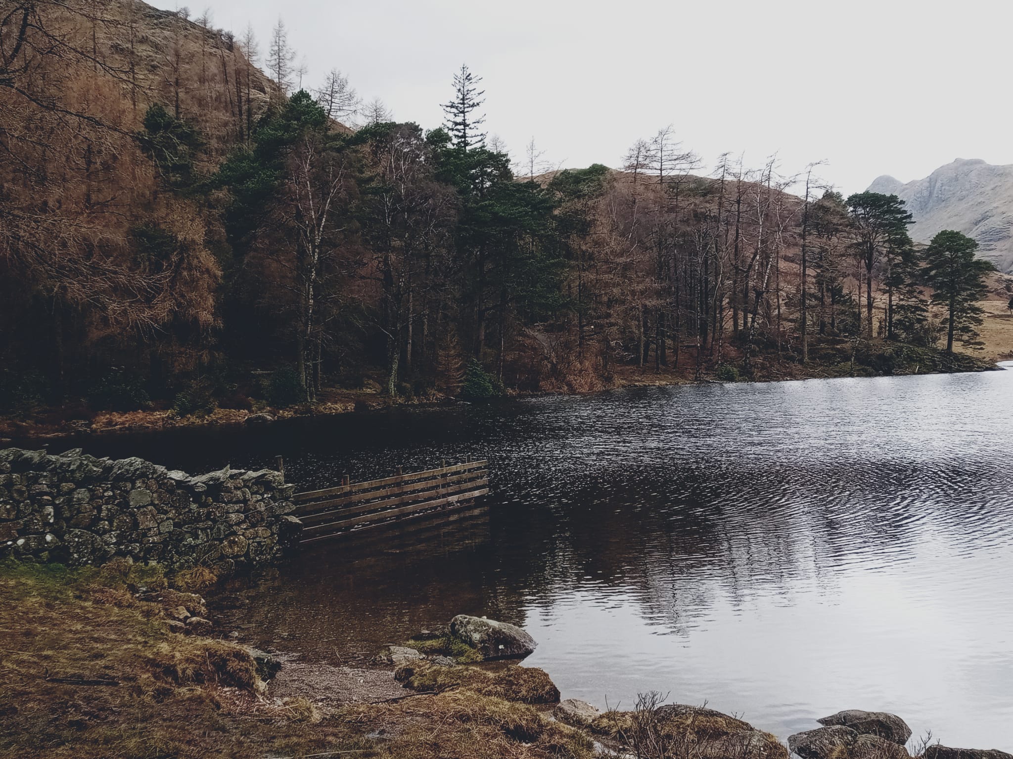
Another filming location used in ‘The Witcher’, Blea Tarn is one of the easiest rambles on our list but also one of the most magical.
A gentle stroll around the atmospheric lake and woodland, the tarn looks like something pulled straight out of a fairytale. Also a hotspot for wild swimmers, Blea Tarn has even been called ‘the jewel in the crown of swimming spots in the Langdales’. After taking a dip yourself, you’d be hard pressed to disagree.
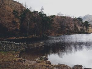
While it is a rather easy 3-kilometre stroll, it is worth noting that the winding & narrow roads you must drive along to reach here might not be everyone’s cup of tea!
Nevertheless, for those who do make the visit, the views upon arrival are simply astounding. It’s also one of the quieter walking spots in the Lakes, making it perfect for those looking to escape the crowds!
For full route info, feel free to read through our Blea Tarn guide!
Jack’s Rake (Pavey Ark)
Starting point: New Dungeon Ghyll, Langdale, LA22 9JX
Distance: 3.7 miles (6km)
Difficulty: Hard
Looking for a real challenge? Then Jack’s Rake might just be for you.
Described by Alfred Wainwright as ‘just about the limit’ for the ordinary fell walker , Jack’s Rake is located on Pavey Ark & feels much more akin to a rock climbing than a hike!

An exposed scramble which is sure to test your mettle, to conquer this hike you’ll need to bring a head for heights and all the correct gear if you wish to succeed.
Once reaching the top of the scramble, take a moment to really soak in that sense of achievement & enjoy the vistas of craggy Lake District countryside from above. You’ve certainly earned it!
For full route info, click through to our Jack’s Rake Guide.
Rydal Caves
Starting point: White Moss Carpark, Ambleside, LA22 9SE
Distance: 2 miles (3.2km)
Difficulty: Easy
Yet another Witcher filming location! Rydal Caves is one of the iconic Lake District hotspots, attracting droves of walkers throughout the year who make the journey explore the old quarry and admire the gorgeous views of its surrounding craggy landscape.
Rich in history, Rydal Cave is essentially the remnants of an old Lake District slate mine dating back to the 19th Century.
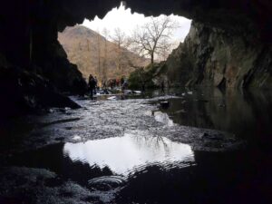
A dramatic example of just how much influence man can have on the landscape, the scenic 2-mile walk to the cavern can be started from either Rydal or White Moss Car Park.
Being a popular walking spot, the car parks can fill up rather quickly, so we’d definitely recommend arriving early if possible!
For a comprehensive lowdown on walking to the historic slate mine, be sure to sift through our Rydal Caves guide here.
Helvellyn (via Striding Edge)
Starting point: Beckside Car Park, Glenridding, Penrith, CA11 0PA
Distance: 8 miles (13km)
Difficulty: Hard
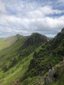
Another notorious ascent – Helvellyn via Striding Edge is perhaps the most popular scramble in the whole National Park.
A steady gradient up the 950-metre peak towards Striding Edge, this incredibly narrow and exposed ridge segment is a real leg-quaker!
While the actual scrambling doesn’t involve anything too technical, it’s the high altitude and exposure which raises the stakes and often catches hikers off-guard. Being so high up, you may even find your vision obscured due to passing clouds.
Nevertheless, if you keep calm and solely focused on what terrain lies immediately in front of you, conquering Striding Edge and reaching Helvellyn’s summit is achievable for those brave enough to tackle it!
Tarn Hows (via Monk Coniston)
Starting point: Coniston LA21 8AA
Distance: 7 miles
Difficulty: Moderate

A crystal clear pool of glistening water surrounded by classic Lake District countryside, its no wonder why Tarn Hows continues to be one of the National Park’s most popular walks!
While the standard loop around the tarn only comes in at around 2 miles long – for those wanting something a little more adventurous – then this 7-mile hike might be right up your street.
Did you know? – The Monk Coniston Estate – where Tarn Hows is situated – was previous owned by Beatrix Potter, later being left to the National Trust after her passing.
Starting from Monk Coniston Car Park on the northern tip of Coniston Water, this route should take most hikers around 2-3 hours to complete and offers plenty in the way of variety.
From enchanted woodlands, idyllic moorlands, craggy hillsides and sublime vantage points from which to bask in vistas of the iconic tarn; be sure to head on over to our ‘Ultimate Tarn Hows Guide’ for all you need to know! 👈
Aira Force
Starting point: Matterdale, Penrith CA11 0JY
Distance: 1 mile (1.6km)
Difficulty: Easy
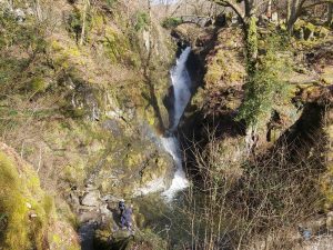
In stark contrast to the Helvellyn trail above, strolling around Aira Force is a much tamer venture.
One of the most famed waterfalls in the National Park, ever since the 18th Century Aira Force has remained one of the national park’s tourist hotspots.
Originally a Victorian pleasure park, the main force crashes 70 feet from below an idyllic stone footbridge, this picturesque site even inspired William Wordsworth in writing his famous poem, ‘I Wandered Lonely as a Cloud’.
Touted as one of the most romantic spots in the Lakes, safe to say bringing your significant other here is bound to get you in the good books. Take note gents!
With the journey to Aira Force often being combined with a stop off at Ullswater, into Glencoyne Deer Park or a walk along the Gowbarrow Trail, safe to say there’s plenty of variety to keep you occupied during a trip here.
Likewise, if waterfalls are your thing, then feel free to pop over to our recent post: ‘9 Stunning Lake District Waterfalls You MUST Visit’
Derwentwater
Starting point: 30A Lake Rd, Keswick CA12 5DG
Distance: 10 miles (16km)
Difficulty: Moderate
Finishing the list with a picture-perfect lakeside walk, Derwentwater is home to a 10-mile waymarked path and provides ramblers with exquisite Lake District views.
Often dubbed ‘Queen of the Lakes’, the trail around Derwentwater passes through ancient woodland and is occupied by a variety of spectacular flora and wildlife. The perfect spot to take a dip, the route is also home to several picnic benches and restaurants, meaning you can really make a full day of it!
Better yet, the lake is literally situated next door to Keswick centre, meaning you can always peruse the town’s charming shops & winding streets after you’re ramble.
While the walk is steady & flat throughout, I’ve rated this route as moderate due to the full loop coming in at a respectable 10 miles in length.
However, for those who may struggle with such a distance, fret not. You by no means have to complete the full loop, many folks simply opt to stroll around a portion of the lake. Whichever segment you choose to ramble around, you’ll be treated to gorgeous views regardless!
Map of Lake District walks
More resources
Well, there you have it. There are countless amazing walks on offer in the Lakes, but these are some of the real gems dotted around the National Park just waiting to be discovered. Pick any of these as your next hiking venture and I’m certain you won’t be disappointed!
For more rambling & outdoor adventure inspiration, why not head on over to the Lake District section of the blog? For instance, we’ve recently just published a post on ‘5 Of The Best Campsites In The Lakes’ I’m sure you’ll enjoy.
Happy walking 🚶🚶